To View The Entire Photo Album Of This Event, Please Click On Either Photograph Above
SEKS Weather Blog
Chase Target:
None
Tornadoes:
Funnel Clouds:
Wall Clouds:
Hail:
Flooding:
00
00
00
00
00
Storm Intercept Summary
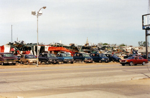
The same tornado that formed 3 miles south of Cherryvale at 1930 CST in eastern Montgomery County, the tornado entered western Labette County at 1934 CST, 10 miles southwest of Dennis. Moving northeast around 35 mph, the tornado passed 4 miles south of Dennis at 1940 CST. At 1945 CST, the tornado entered southwest Parsons where it inflicted major damage to a law enforcement center, a movie theater, and a carnival. In all, 750 buildings were damaged of which 633 were homes. Of the homes, 53 were destroyed, 112 sustained major damage and 468 received minor damage. Of the 117 commercial buildings that sustained damage, 20 were destroyed, 28 received major damage, and 69 received minor damage. Total damage estimate: $40 million. A total of 27 people were injured, most were minor. Though inflicting F3 damage when it hit Parsons, the tornado possessed F1 intensity for most of it's track. This same tornado would continue moving northeast, clipping southeast Neosho County. Area newspapers contributed to this report.
An F2 tornado entered the southwest corner of Crawford County west of McCune and traveled northeast over the southwest section of the county. The intermittent damage path was 300 yards wide. Although the tornado stayed over rural areas, it still managed to severely damage or destroy 5 homes and several outbuildings. Four persons were injured by flying debris. The tornado lifted about 6 miles northeast of McCune.
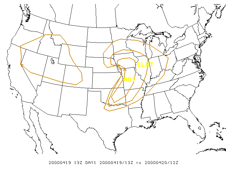
SPC Convective Outlook
At 7:56 CDT On April 19, 2000
SPC Tornado Outlook
(Not Available)
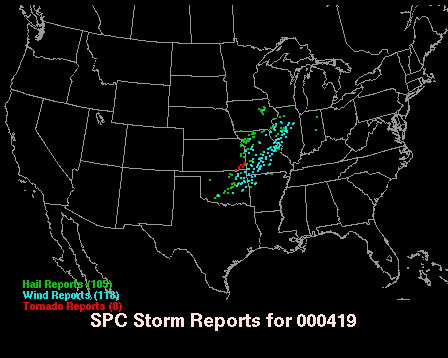
SPC Storm Reports For April 19, 2000
Truck Damaged On Country Mart Parking Lot
This Will Be Updated Very Soon!!!
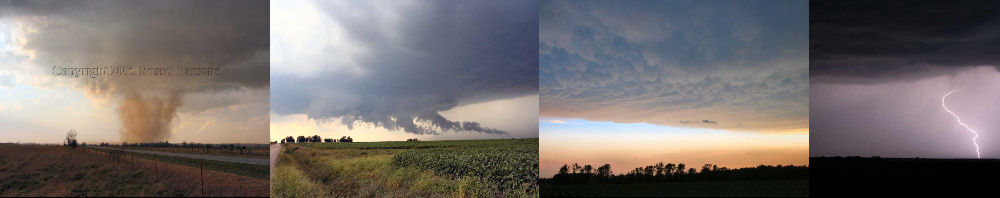
PHOTO GALLERY
NEXRAD WEATHER RADAR IMAGES
STORM PREDICTION CENTER CONVECTIVE OUTLOOK FOR THIS DAY
STORM REPORTS FOR THIS EVENT
NEWSPAPER ARTICLES AND OTHER STORM CHASER ACCOUNTS
Newspaper Articles For April 19, 2000
Other Storm Chaser Accounts For April 19, 2000
Parsons, Kansas Tornado
April 19, 2000
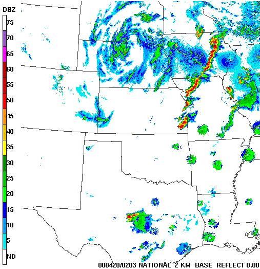
This Radar Image Shows The Tornado Producing Supercell As It Moves Over Parsons, Kansas At About 8:03 P.M.
Parsons Motor Company Damaged By Tornado
