To View The Entire Photo Album Of This Event, Please Click On Either Photograph Above
SEKS Weather Blog
Chase Target:
None
Tornadoes:
Funnel Clouds:
Wall Clouds:
Hail:
Flooding:
00
00
00
00
00
Storm Intercept Summary
This storm chase was a backyard chase for me. Severe thunderstorms developed to the Southeast of Pittsurg, Kansas and I jumped in the car went out to see what I could see. I did get several good photographs of cumulonibus storm clouds. Check out my photo gallery pictures at the link below! The photographs were looking towards the Southeast from Northern Cherokee County Kansas.
AS TIME PERMITS, I WILL ADD NEXRAD WEATHER RADAR IMAGES OF THIS STORM EVENT IN THIS AREA OF THE PAGE.
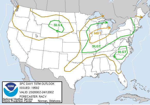
SPC Convective Outlook
At 3:00 P.M. CDT On May 23, 2004
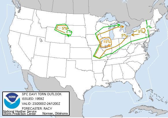
SPC Tornado Outlook
At 3:00 P.M. CDT On May 23, 2004
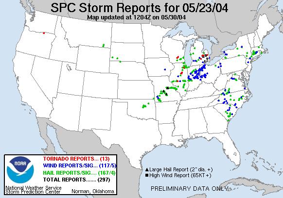
SPC Storm Reports For May 23, 2004
None Available At This Time
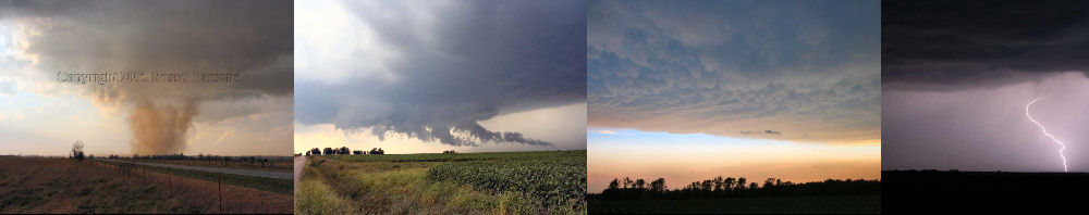
PHOTO GALLERY
NEXRAD WEATHER RADAR IMAGES
STORM PREDICTION CENTER CONVECTIVE OUTLOOK FOR THIS DAY
STORM REPORTS FOR THIS EVENT
NEWSPAPER ARTICLES AND OTHER STORM CHASER ACCOUNTS
Newspaper Articles For May 23, 2004
Other Storm Chaser Accounts For May 23, 2004
Severe Storms
May 23, 2004
National Weather Service Damage Assessment For May 23, 2004