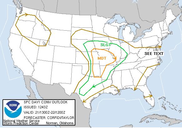
SPC Convective Outlook
At 7:43 AM CDT On April 21, 2005
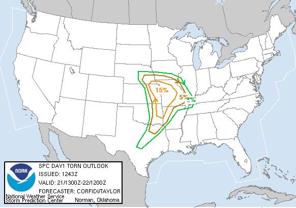
SPC Tornado Outlook
At 7:43 AM CDT On April 21, 2005
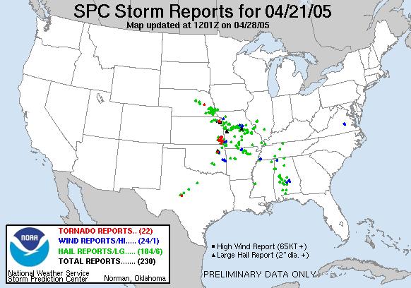
SPC Storm Reports For April 21, 2005
Wichita National Weather Service Storm Damage Survey For 04/21/2005
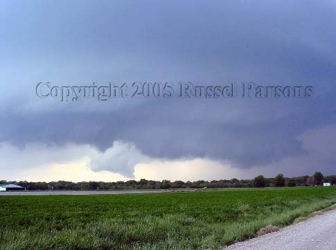
The Wall Cloud Can Be Seen Towards Left Side Of This Picture Taken Looking Northwest From NE 40th St. And Highway 101 East Of Weir, Kansas
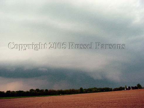
"Mesocyclone"
Looking North-Northwest From Five Miles East Of U.S. 69 Highway On NE Scammon Road In Cherokee County, Kansas
To View The Entire Photo Album Of This Event, Please Click On Either Photograph Above
AS TIME PERMITS, I WILL ADD NEXRAD WEATHER RADAR IMAGES OF THIS STORM EVENT IN THIS AREA OF THE PAGE.
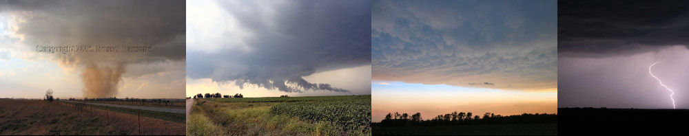
PHOTO GALLERY
NEXRAD WEATHER RADAR IMAGES
STORM PREDICTION CENTER CONVECTIVE OUTLOOK FOR THIS DAY
STORM REPORTS FOR THIS EVENT
NEWSPAPER ARTICLES AND OTHER STORM CHASER ACCOUNTS
Newspaper Articles For April 21, 2005
Other Storm Chaser Accounts For April 21, 2005
Crawford County Wall Cloud
April 21, 2005
Storm Chasing Blog
Chase Target:
Yates Center, Kansas
Storm Intercept Summary
I intended to chase in Southeast Kansas today, and this storm chase wound up being a local chase for me. A supercell thunderstorm developed and moved East across Southern Crawford County and Northern Cherokee County along the U.S. 400 Highway corridor. I stayed about a mile south of the storm as it moved East/Southeast. The thunderstorm was tornado warned by the National Weather Service, but I did not witness a tornado with this supercell. I did photograph a photogenic wall cloud and mesocyclone with this supercell, along its path from about Weir, Kansas to Asbury, Missouri! Enjoy the photographs below.
Tornadoes:
00
00
Funnel Clouds:
Wall Clouds:
02
No
No
Flooding:
Hail: