Other Storm Chaser Accounts For May 30, 2006
Chase Target:
None
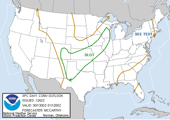
SPC Convective Outlook
At 7:42 AM CDT On
May 30, 2006
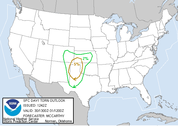
SPC Tornado Outlook
At 7:42 AM CDT On
May 30, 2006
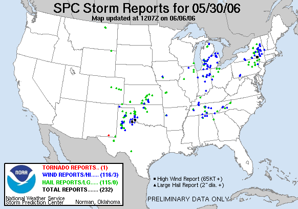
SPC Storm Reports For May 30, 2006
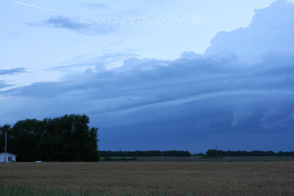
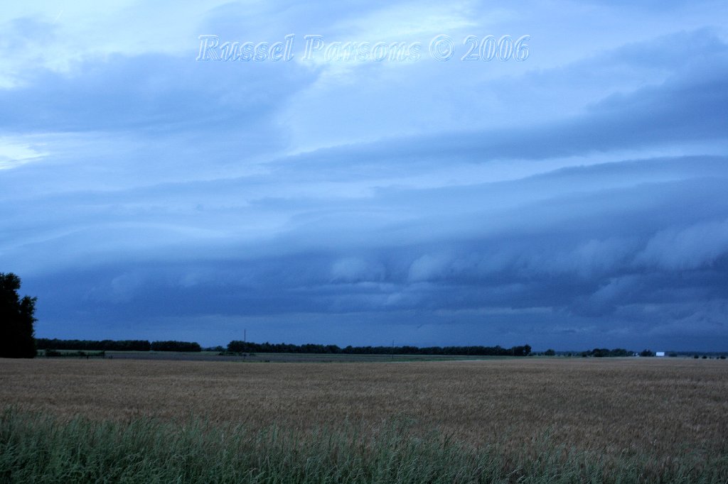
Shelf Cloud With A Non-Severe Thunderstorm Located Southwest Of Girard, Kansas
Shelf Cloud With A Non-Severe Thunderstorm Located Southwest Of Girard, Kansas
No articles have been located about this event!!
No National Weather Service Damage Assessment Has Been Found For May 30, 2006
Check Other Storm Chaser's Accounts For This Day At The Stormtrack Forums
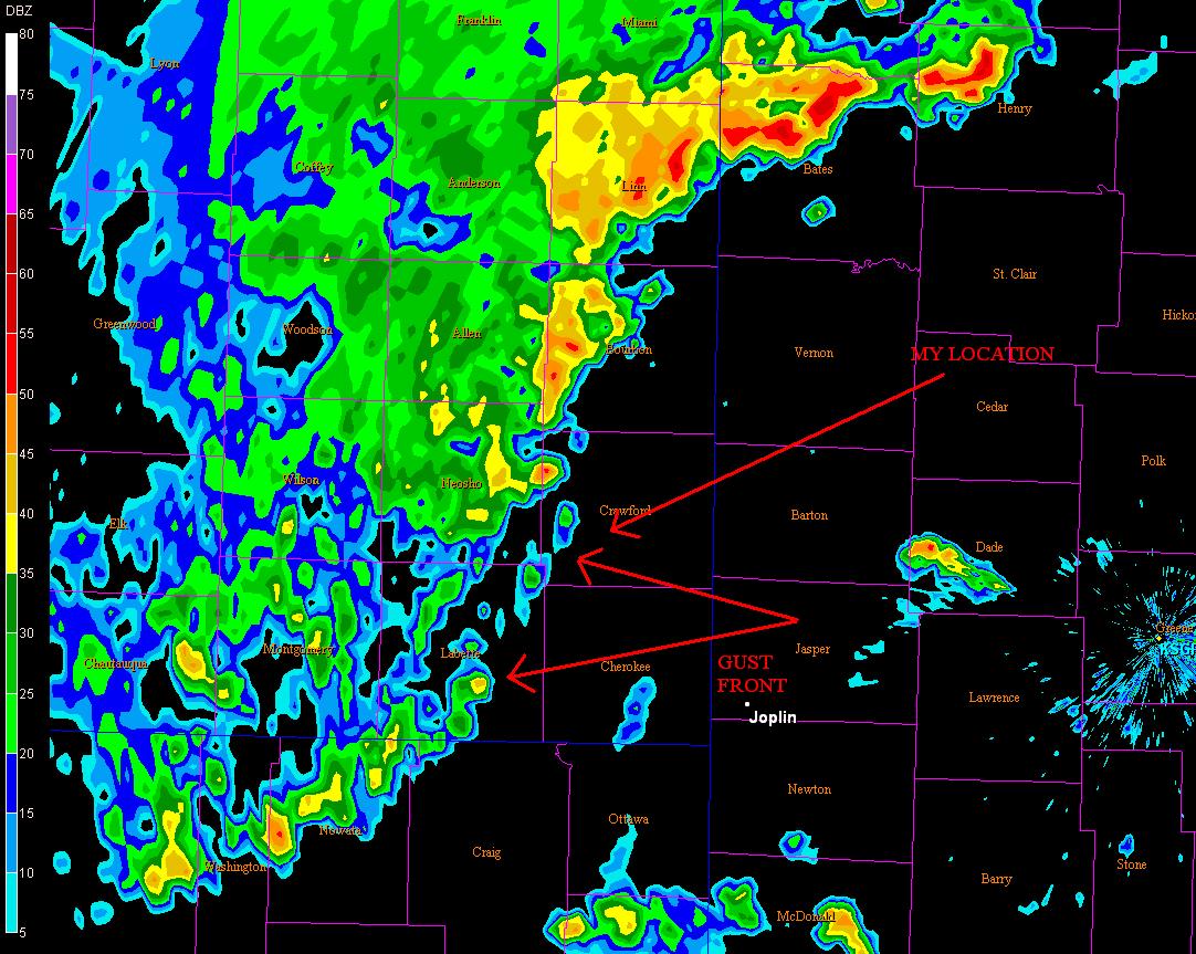
Springfield NWS Nexrad Radar 8:24 P.M.
Base Reflectivity Image This Image Shows The Location Of The Gust Front
And My Location When The Above Photos Were Taken. (Click To Enlarge)
To View The Entire Photo Album Of This Event, Please Click Here
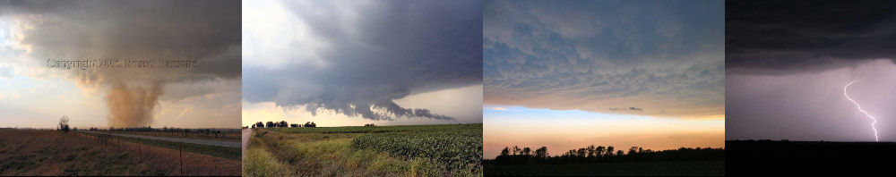
PHOTO GALLERY
NEXRAD WEATHER RADAR IMAGES
STORM PREDICTION CENTER CONVECTIVE OUTLOOK FOR THIS DAY
STORM REPORTS FOR THIS EVENT
NEWSPAPER ARTICLES AND OTHER STORM CHASER ACCOUNTS
Newspaper Articles For May 30, 2006
Storm Intercept Summary
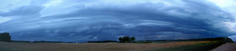
Since this severe weather season has been so darn slow, I decided to head a few miles Northwest of my home, and watch a gust front move across the area. A gust front is an outflow boundary that is the leading edge of gusty surface winds from thunderstorm downdrafts; sometimes associated with a shelf cloud or roll cloud. It was nothing out of the ordinary, but I was able to get enough photographs of the gust front to make a panoramic photo. To make the panoramic photograph, I used software to "stitch" several photos together. This is my first experience with this type of photograph editing, and I look forward to doing a lot more of it.
Gust Front South Of Girard, Ks.
May 30, 2006
Tornadoes:
Funnel Clouds:
Wall Clouds:
Hail:
Flooding:
No
No
00
00
00