Other Storm Chaser Accounts For March 23, 2009
Storm Chasing Blog
Chase Target:
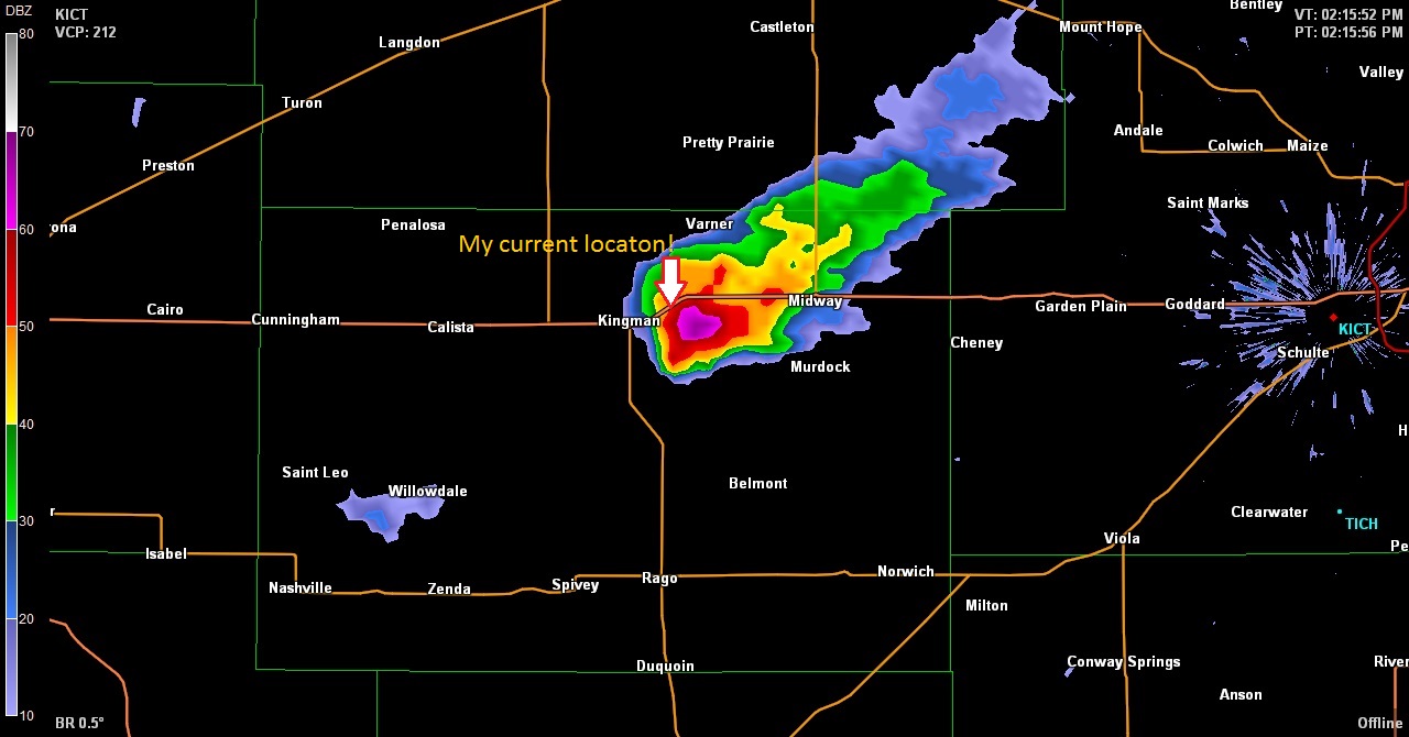
Kingman, Kansas
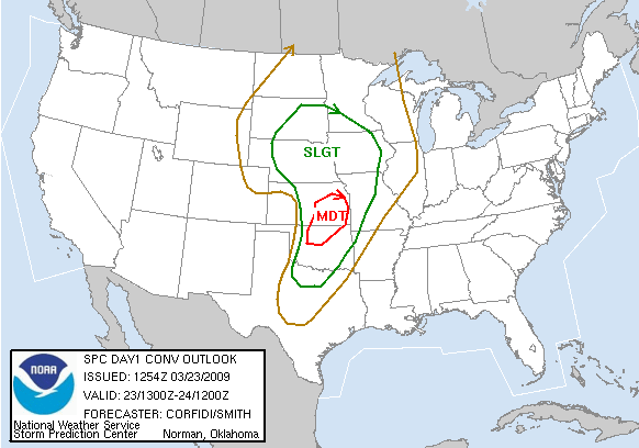
SPC Convective Outlook
At 7:54 AM CDT On
March 23, 2009
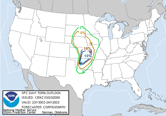
SPC Tornado Outlook
At 7:54 AM CDT On
March 23, 2009
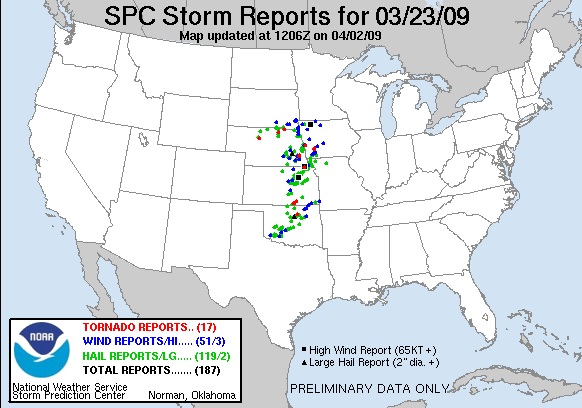
SPC Storm Reports For March 23, 2009
Stay Tuned!
No articles have been located about this event!!
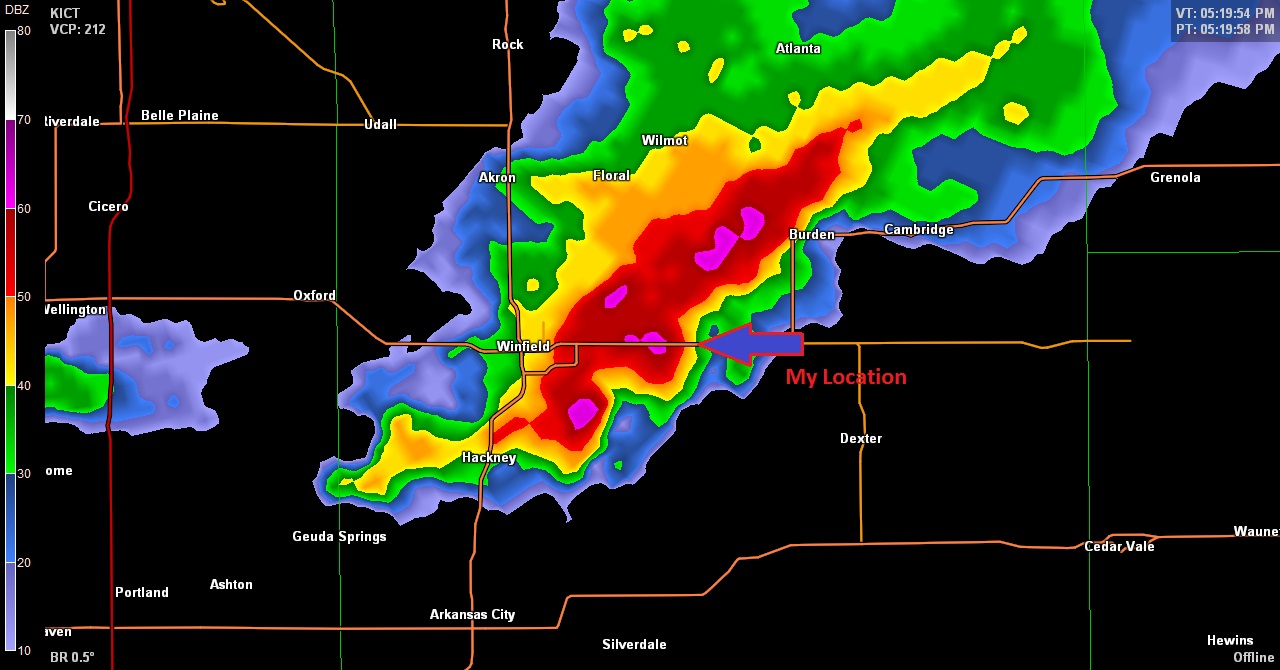
YouTube Video Of The Funnel Cloud Southeast Of Winfield, Kansas
Courtesy Of TheStormReport.com
To View The Entire Photo Album Of This Event, Please Click Here (Clicking The Slideshow Is The Best Option)
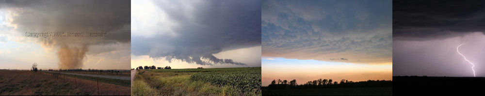
PHOTO GALLERY
NEXRAD WEATHER RADAR IMAGES
STORM PREDICTION CENTER CONVECTIVE OUTLOOK FOR THIS DAY
STORM REPORTS FOR THIS EVENT
NEWSPAPER ARTICLES AND OTHER STORM CHASER ACCOUNTS
Newspaper Articles For March 23, 2009
Storm Intercept Summary
Today turned into a pretty good early Spring storm chase day. After past experiences with severe storms in March, I didn't really expect much from today's storms. We started off with a Moderate Risk of severe storms in Southeast Kansas, and I decided to make the trek west with storm chaser Tyler Costantini.
We arrived in Kingman, Kansas just after noon, and shortly thereafter the first storm of the day passed just to the east of Kingman. We saw a rotating wall cloud and a brief funnel cloud as the storm moved off to our northeast at approximately 45 MPH
While we were attempting to stay up with the first storm, a new supercell thunderstorm fired up in North Central Oklahoma, and moved into Kansas near Arkansas City, Kansas. We finally got into position to see the updraft portion of this tornado warned supercell, when we got about eight miles east of Winfield, Kansas. We witnessed a rotating wall cloud with a funnel cloud.
After this storm weakened and darkness loomed, we did some after dark chasing near Tulsa, Oklahoma.
South Central Kansas Supercells
March 23, 2009
Tornadoes:
Funnel Clouds:
Wall Clouds:
Hail:
Flooding:
00
02
02
Penny
No