Other Storm Chaser Accounts For May 13, 2009
Storm Chasing Blog
Chase Target:
Chillicothe, Missouri
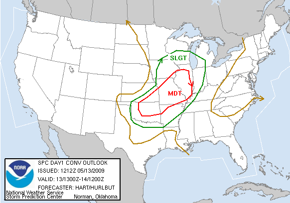
SPC Convective Outlook
At 7:12 AM CDT On
May 13, 2009
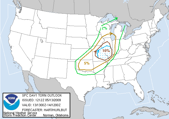
SPC Tornado Outlook
At 7:12 AM CDT On
May 13, 2009
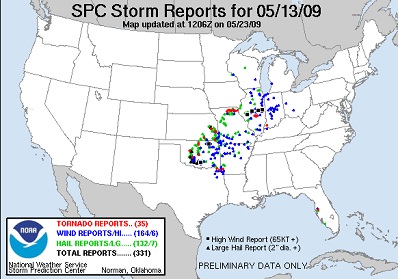
SPC Storm Reports For May 13, 2009
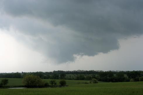
Wall Cloud Near Chillicothe, Missouri In North Central Missouri
No articles have been located about this event!!
YouTube Video Of The Kirksville, Missouri Tornado That I Missed On This Day.
To View The Entire Photo Album Of This Event, Please Click Here (Clicking The Slideshow Is The Best Option)
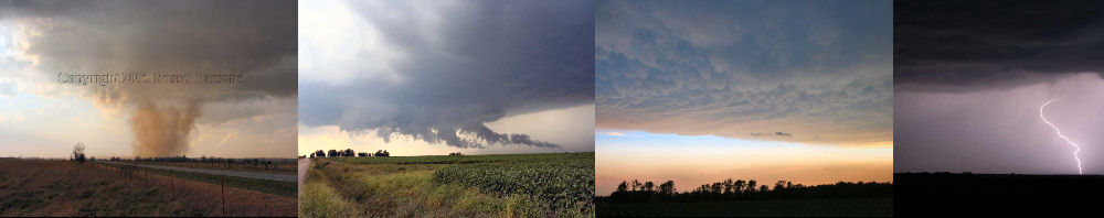
PHOTO GALLERY
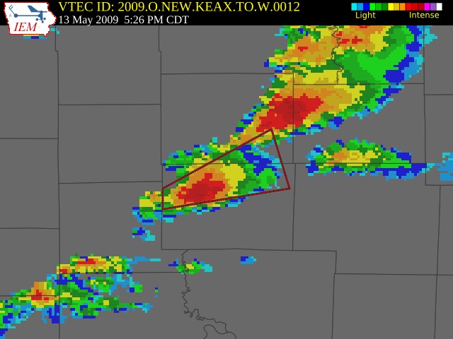
NEXRAD WEATHER RADAR IMAGES
STORM PREDICTION CENTER CONVECTIVE OUTLOOK FOR THIS DAY
STORM REPORTS FOR THIS EVENT
NEWSPAPER ARTICLES AND OTHER STORM CHASER ACCOUNTS
Newspaper Articles For May 13, 2009
Storm Intercept Summary
On this particular day, I drove to North Central Missouri where my target was to the Northeast Of Kansas City, Missouri. I did witness a tornado warned supercell thunderstorm near Chillicothe, Missouri and that storm did contain a pretty decent wall cloud. I did not see any funnel clouds or tornadoes with this particular supercell thunderstorm. I decided to stay in North Central Missouri, which was a huge mistake. Later in the afternoon, a large tornado struck the north side of Kirksville, Missouri, which is located in the Northeast part of Missouri. I was just too far away from that area to see this tornado. You win some and you lose some!
North Central Missouri Supercells
May 13, 2009
Tornadoes:
Funnel Clouds:
Wall Clouds:
Hail:
Flooding:
00
00
01
None
No