Other Storm Chaser Accounts For May 13, 2009
Storm Chasing Blog
Chase Target:
Pittsburg, Kansas
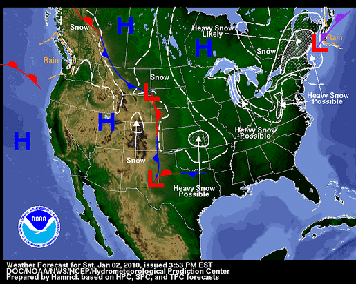
January 02, 2010 Forecast Map Showing Heavy Snowfall In Southeast Kansas
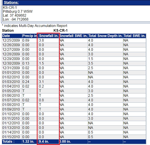
Pittsburg, Kansas Snowfall Between December 25, 2009 And January 15, 2010
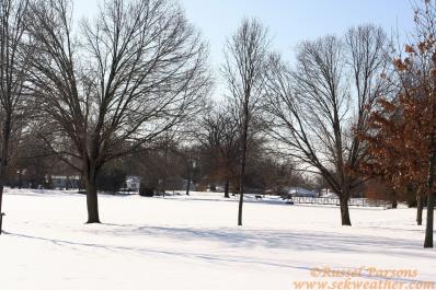
The Calm After The Snow Storm In Southeast Pittsburg, Kansas
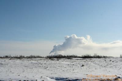
The Power Plant Near Asbury, Missouri Putting On Its Own Show On A Cold Winter Day
No articles have been located about this event!!
NONE FOUND!
These will be added when time permits...
To View The Entire Photo Album Of This Event, Please Click Here (Clicking The Slideshow Is The Best Option)
PHOTO GALLERY
NEXRAD WEATHER RADAR IMAGES
STORM PREDICTION CENTER CONVECTIVE OUTLOOK FOR THIS DAY
STORM REPORTS FOR THIS EVENT
NEWSPAPER ARTICLES AND OTHER STORM CHASER ACCOUNTS
Newspaper Articles For May 13, 2009
Storm Intercept Summary
An intense winter storm system brought heavy snow, significant sleet and light freezing rain accumulations in addition to strong winds to southeast Kansas and southwest Missouri Christmas Eve into early Christmas Day. Snowfall accumulations of four to six inches were common on top of sleet accumulations of one quarter to one inch. Near blizzard conditions developed across southeast Kansas and far southwest and west central Missouri as the surface low tracked nearly due north from Arkansas to northeast Missouri. Sustained winds of 20 to 35 mph with higher gusts were common reducing the visibility, and causing blowing and drifting snow. Wind chill values were well below zero. This winter storm had a severe impact on holiday travel.
Heavy snow accumulations of four to six inches in addition to sleet accumulations of one half to one inch and a minor accumulation of freezing rain. Winds of 20 to 35 mph resulted in near blizzard conditions at times and dangerous wind chills. Holiday travel was severely impacted.
Snow Storm In Pittsburg, Kansas
January 09, 2010
Tornadoes:
Funnel Clouds:
Wall Clouds:
Hail:
Flooding:
00
00
00
None
No