Other Storm Chaser Accounts For November 22, 2010
Storm Chasing Blog
Chase Target:
Pittsburg, Kansas
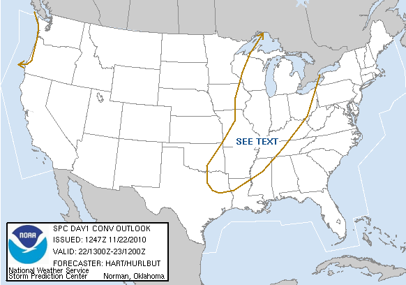
SPC Convective Outlook
At 7:51 AM CDT On
November 22, 2010
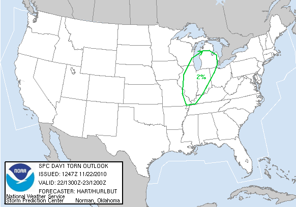
SPC Tornado Outlook
At 7:51 AM CDT On
November 22, 2010
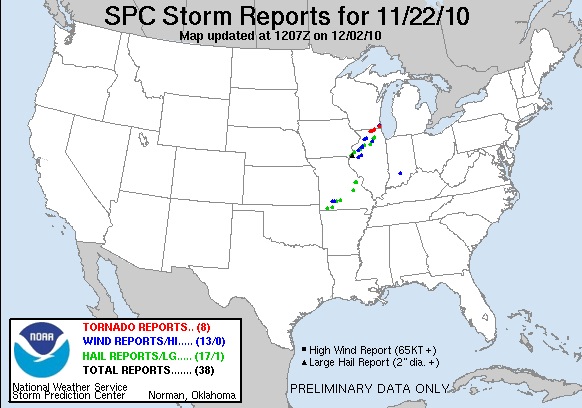
SPC Storm Reports For November 22, 2010
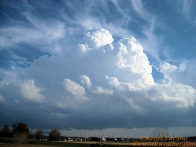
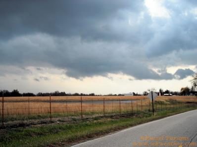
Developing Thunderstorms Along A Cold Front In Eastern Crawford County Kansas
A Wall Cloud That Formed Under A Non-Severe Thunderstorm Southeast Of Pittsburg, Kansas
No articles have been located about this event!!
NONE FOUND!
These will be added when time permits...
To View The Entire Photo Album Of This Event, Please Click Here (Clicking The Slideshow Is The Best Option)
PHOTO GALLERY
NEXRAD WEATHER RADAR IMAGES
STORM PREDICTION CENTER CONVECTIVE OUTLOOK FOR THIS DAY
STORM REPORTS FOR THIS EVENT
NEWSPAPER ARTICLES AND OTHER STORM CHASER ACCOUNTS
Newspaper Articles For November 22, 2010
Storm Intercept Summary
A cold front swept through Southeast Kansas causing non-severe thunderstorms to develop along the front over Eastern Crawford County Kansas. The thunderstorms continued to develop, and I witnessed a small wall cloud about a mile Southeast of Pittsburg, Kansas. These thunderstorms continued to develop along the cold front and moved East into Southwest Missouri. These storms dumped some large hail over the Springfield, Missouri area, and caused some strong staight line winds in the same area. Just goes to show that severe weather can occurr in November. It was fun watching these storms develop over Crawford County Kansas and then move off to the East into Southwest Missouri.
Storms In Crawford Cnty. KS.
November 22, 2010
Tornadoes:
Funnel Clouds:
Wall Clouds:
Hail:
Flooding:
00
00
00
None
No