Other Storm Chaser Accounts For July 26, 2012
Storm Chasing Blog
Photo Gallery
Chase Target:
Tulsa, Oklahoma
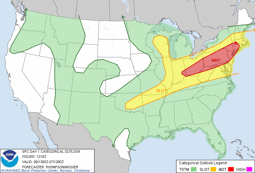
SPC Convective Outlook
At 7:19 AM CDT On
July 26, 2012
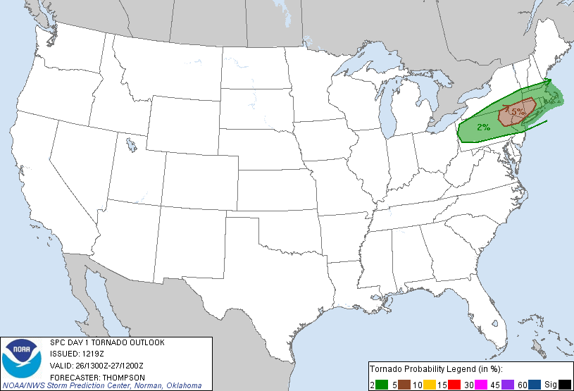
SPC Tornado Outlook
At 7:19 AM CDT On
July 26, 2012
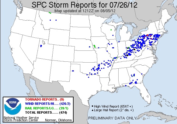
SPC Storm Reports For July 26, 2012
No Photographs Of This Event Were Taken, Since No Storms Developed Near My Target Area Until After Dark!
No articles have been located about this event!!
NONE FOUND!
These will be added when time permits...
To View The Entire Photo Album Of This Event, Please Click Here (Clicking The Slideshow Is The Best Option)
PHOTO GALLERY
NEXRAD WEATHER RADAR IMAGES
STORM PREDICTION CENTER CONVECTIVE OUTLOOK FOR THIS DAY
STORM REPORTS FOR THIS EVENT
NEWSPAPER ARTICLES AND OTHER STORM CHASER ACCOUNTS
Newspaper Articles For July 26, 2012
Storm Intercept Summary
Today started out with a slight risk of severe thunderstorms across Northeast Oklahoma. I haven't really had the chance to storm chase much this year, so I decided to drive to the Tulsa, Oklahoma area in search of a thunderstorm. Well, things didn't turn out so well on this trip. Thunderstorms did not develop until much later in the evening, and there were only a few severe wind events in the area of Northeast Oklahoma. I decided to call off the storm chase, and I took photographs of trains in Tulsa, Oklahoma. Railfanning is my second hobby, so this was not a wasted trip to Northeast Oklahoma, at all!
A Busted Chase South Of Tulsa, Ok.
July 26, 2012
Tornadoes:
Funnel Clouds:
Wall Clouds:
Hail:
Flooding:
00
00
00
None
No