Other Storm Chaser Accounts For May 31, 2013
Storm Chasing Blog
Chase Target:
Guthrie, Oklahoma
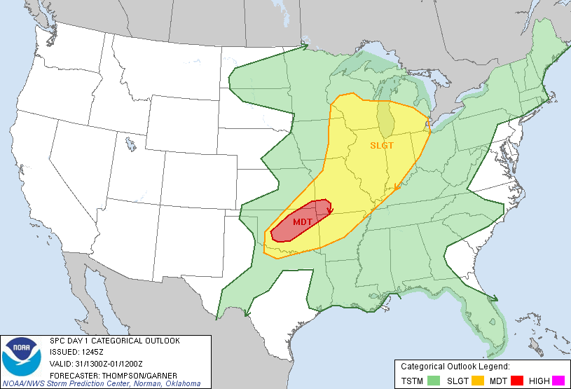
SPC Convective Outlook
At 7:45 AM CDT On
May 31, 2013
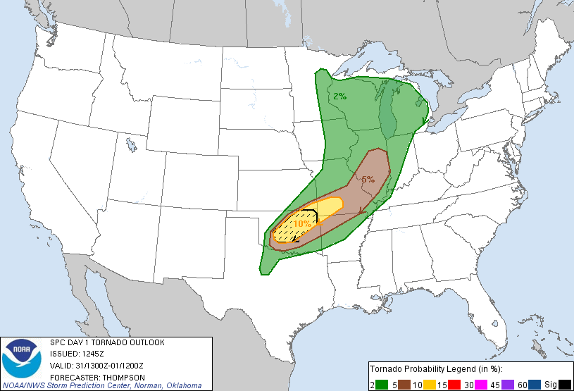
SPC Tornado Outlook
At 7:45 AM CDT On
May 31, 2013
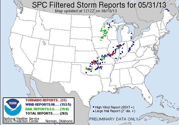
SPC Storm Reports For May 31, 2013
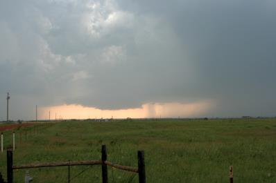
Wall Cloud Approximately Two Miles South-Southwest Of Kingfisher, Oklahoma
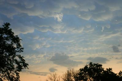
Mammatus Clouds Southeast Of Oklahoma City, Oklahoma From The El Reno Supercell
Stay Tuned!
YouTube Video Of The El Reno, Oklahoma Huge Tornado About Miles To My South
(Courtesty: Pecos Hank)
YouTube Video El Reno: Lessons Learned From The Most Dangerous Tornado In Storm Observing History (Courtesy: Norman National Weather Service)
These will be added when time permits...
To View The Entire Photo Album Of This Event, Please Click Here (Clicking The Slideshow Is The Best Option)
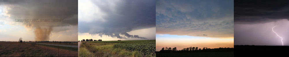
PHOTO GALLERY
NEXRAD WEATHER RADAR IMAGES
STORM PREDICTION CENTER CONVECTIVE OUTLOOK FOR THIS DAY
STORM REPORTS FOR THIS EVENT
NEWSPAPER ARTICLES AND OTHER STORM CHASER ACCOUNTS
Newspaper Articles For May 31, 2013
Kingfisher, Oklahoma Tornado!
May 31, 2013
Tornadoes:
Funnel Clouds:
Wall Clouds:
Hail:
Flooding:
01
01
01
None
No